


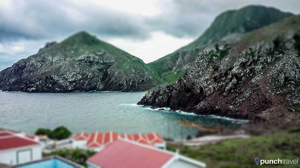
Chances are you’ve probably never heard of the small Dutch island of Saba. Located 28 miles southwest from neighboring Sint Maarten, Saba is not your typical Caribbean island. For starters, there are no beaches. No street vendors hawking beach chairs and beer buckets, no cruise ship tourists strolling slowly through the streets. Known as “The Unspoiled Queen”, Saba is truly a step back into what Caribbean lifestyle was like and is a welcome respite from the tourist hubs that some of the other Caribbean islands have become.
Saba, Say-What?
First, a bit of history: the island of Saba was formed from the top of a volcano (don’t worry, it has been inactive for over 5,000 years). Its earliest inhabitants were the Arawak Indians, who settled in many islands across the Caribbean. It wasn’t until 1632 that the island was first colonized by European settlers, by way of a group of shipwrecked Englishman. Not long after, Dutch settlers from nearby Sint Eustasius came to Saba to inhabit and colonize the island. The island changed hands between the Netherlands, England, Spain and France for the next 200 years before settling on Dutch rule since 1816. Today, Saba is part of a special municipality of the Caribbean Netherlands, along with Bonaire and Sint Eustasius, known as the BES Islands.
Less than 2,000 people live on Saba, but the island has benefited from a growing interest in eco-tourism with 25,000 tourists a year who visit for its famous diving and hiking. The two main towns in Saba are Windwardside and The Bottom, the municipal center.
Getting to Saba
Arriving is not an easy feat and can be accomplished either by ferry from Sint Maarten, which deposits you in The Bottom on one side of the island, or by air from Sint Maarten which drops you off at the edge of a cliff in Flatpoint. So pick your poison, would you rather spend 90 minutes on a rocking boat or 12 minutes in a small propeller plane hurtling towards the cliffs and the shortest commercial air strip in the world?!?
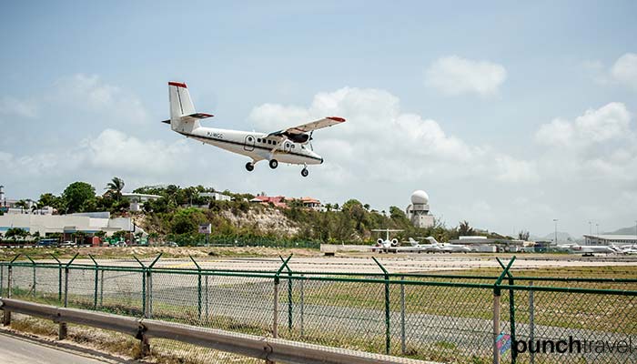
I chose to get it over with quickly by air, but it turned out to be a pleasant ride. Onboard the Winair DH-6 Twin Otter, the 16 seats are packed in tightly and there is no air circulation let alone air conditioning. It’s a bit claustrophobic for me but as this was already my second propeller jet trip in a week, I took it like a pro. I had a clear view of the cockpit and it was neat to see all the different instruments, maps and tools that they use to fly. Take off consists of revving up the propellers to maximum speed, so earplugs are recommended or else your ears will be ringing for a bit afterwards. The two pilots work together to pull the plane off the ground and then it’s off into the air. Flying in the depressurized plane over the vast ocean, I was acutely aware of my surroundings and the openness of the air and sea around me.
Landing at Juancho E. Yrausquin Airport in Saba is a sight to be seen. As we approached, we seemed to be heading straight for the cliffs before finally the plane turned to hug the coastline before descending on to the runway. Landing at this airport can only be done by small regional aircraft and a special set of skills is required to master the landing.
After quickly passing through customs, we exited the small airport in search of transportation. There were a few taxis waiting at the airport and can take you wherever you need to. Note that taxi rates are pre-set by the government so make sure to verify the rate with your driver before you get in.
The Sabans are quite proud of their road, cleverly called, The Road, because it is known as “the road that couldn’t be built”. Built in 1943, it was built entirely by hand! It stretches from Zion’s Hill where the airport is, and twists around the cliffsides, providing spectacular views of the neighboring islands and stunning seascapes. It passes through the harbor in Fort Bay, the capital city of The Bottom, and the disappearing beach at Well’s Bay.
Windwardside, at the Base of Mt. Scenery
Our journey took us to the very laid-back and quaint stretch of land that embodies the town of Windwardside. We were here to tackle the hike to the peak of Mount Scenery. But first we had to stock up on snacks to fortify our climb.
There are two grocery stores in Windwardside, both that open early enough if you start out for your hike early, while the weather is still cool. We loaded our packs with bottled water, chicken and beef patties, and nuts.
Further down The Road is the Trail Shop, where you can pick up a Trail Map as well as walking sticks for your hiking adventure. We arrived before the shop had opened, and thus made the mistake of not picking up hiking sticks. While the hike is certainly doable without a hiking stick, you’ll be happy to have one, especially on the descent. From the Trail Shop, signs point in every which direction, directing you to the different trails. Not far from the Trail Shop is the trail head for the Mt. Scenery hike.
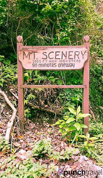
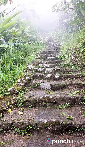
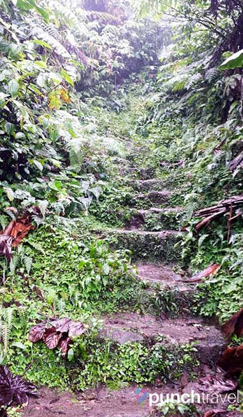
Prepare your thighs for a workout, as the hike boasts 1,064 steps to the summit, though I tried not to think about how many steps away from 1,064 I was as I placed each foot. With each step, I climbed deeper and higher into the jungle with luscious greenery surrounding me. Without passing a single other hiker on the ascent, I felt like Indiana Jones searching for the Temple of Doom, careful not to step on any creatures or ancient ruins. I passed by many interesting flora and fauna, including lime trees, soursop trees, banana trees, and the national flower, the black-eyed susan. Remember, take only pictures, leave only footprints!
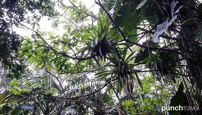
The steps to the summit can be wet and moss covered so having a hiking stick can be helpful to steady your footing. As I ascended, I was literally in the clouds. The air was fresher and I could see the mist of the clouds forming around me and at one point I found myself caught in a light rainstorm. Luckily I had packed a light rain jacket which I used along with the cover of a large banana leaf. There are also three shelter areas along the way where you can rest and take cover if needed.
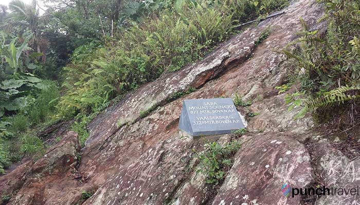
Near the top of the mountain, the path splits, one going left towards the summit and one going right towards a scenic view. At the peak, it was too cloudy to see clearly around me, but I stopped to take in the clear, crisp air and revel in the knowledge that I climbed the highest peak in the Kingdom of the Netherlands.
Coming back down is actually more difficult (in a different way) than going up. Descending, I had to deal with the balancing act of not slipping in the mud or the moss, as well as the impact to my knees of going down 1,064 steps. Again, a hiking stick would have helped with both of these problems. We crossed paths with more hikers on the way back, as the ferry from Sint Maarten had just arrived, and I gave words of encouragement to my fellow hikers.
Finally reaching the bottom, we were relieved but exalted. You can pick up a certificate of completion from the Trail House for $2, or a snazzy souvenir t-shirt.
Back in Windwardside, there are several restaurants to replenish your calorie count, including Sea Witch Bar and Grill, Swinging Doors, or Bizzy B for a sandwich and coffee. Since we had already eaten our patties while on the mountain, I opted to reward myself with an ice cream from the Saba Snack.
Other Things To Do in Saba
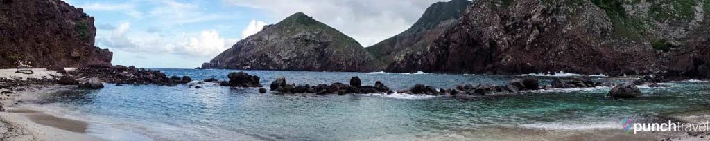
If your legs are not yet jello, there are several other hikes that you can try. From the Mt. Scenery trail, you can hike to The Bottom where several other hikes begin. For an easy hike, head back towards the airport in Flatpoint to view the tidepools and the only “beach” in Saba. Another interesting hike takes you to an old sulphur mine. You can spend a week exploring the island of Saba and its numerous hiking trails, which range in level of difficulty.
As it were, my legs were jello so we decided to spend the rest of the afternoon exploring the town of Windwardside. There are two museums that provide a look into the history of Saba. The Harry L. Johnson Museum, housed in a 160-year-old Sea Captain’s Cottage, recreates a home from that era, complete with artifacts from the time period. The museum guide onsite welcomed us to the museum and gave us a short tour that explained the history of the home and Saban culture, and only a small donation of $2 per person is requested. Though the museum is small, it is situated on a nice piece of land, so afterwards we took a stroll through the yard and a nap in the veranda.
Not far from the Harry L. Johnson museum is the Dutch Museum. Similarly, it is housed in a traditional Saban cottage and contains Dutch antiques and artifacts that date from 150 to 400 years old. Here you will find Dutch tiles and engravings, as well as traditional Saban lace, porcelain, furniture and paintings.
Diving in Saba
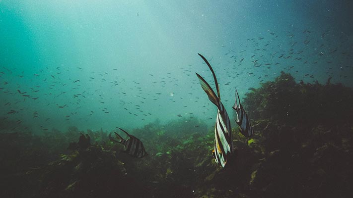
I am not a diver by any means so I cannot speak to the quality of its dive sites, but know that Saba is world-renowned for its diving. Saba Marine Park encompasses all of the island and includes the waters and seabed to a depth of 200 feet. Because Saba is literally a volcano rising out of the water, the steepness of the coastal zone makes shore diving virtually impossible and therefore all diving must be with one of Saba’s licensed dive centers which you can find throughout The Bottom and Windwardside.
Saying Goodbye to Saba
Forget about TSA regulations or your usual airport processes. In this tiny airport, the flight controller is also the check-in agent and there is no security to pass through so feel free to keep your bottled water with you. There is a small bar/cafe at the airport where you can grab a drink before your flight, or feel free to wander toward the tide pools not far from the airport where the Sea Grape Restaurant is located.
Once you cross the tarmac into the plane, the departure from Saba’s airport is another experience to reckon with. The plane revs up its propellers and then off we went off the edge of the runway, seemingly dropping off over the edge of the cliff and soaring above the sparkling sea into the sunset towards Princess Juliana airport.
When you’ve had enough of the beaches, the casinos, and the commercialization of Sint Maarten, spend some time in Saba. There is much to see and do in Saba if ecotourism is your thing, from the miles of hiking trails to the depths of the dive sites. Or just simply relax and get away from it all in one of the resorts or eco-lodges that dot the mountainside. Nature comes calling in the beautiful island of Saba. Even if it’s just a day trip, you’ll be happy to visit and soak in a different part of the Caribbean. And at the very least, have a respite from the mosquitoes, of which Saba has none!
